System for optimal location of biomass plants
The European project BioEnerGIS, funded under the “IEE” – Intelligent Energy for Europe programme, aims to support decision-makers in planning the sustainable exploitation of biomass at the regional scale through advanced analysis and decision support tools. BioEnerGIS was developed through the collaboration of seven partners from different countries: Italy, Austria, Slovenia, Belgium, and the United Kingdom.
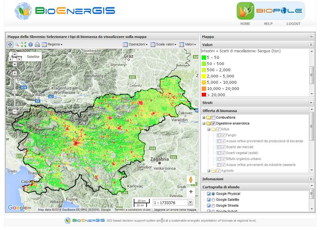
Within the project, BIOPOLE was developed as an optimisation model integrated into a Geographic Information System (GIS)-based Decision Support System (DSS), featuring a WebGIS interface to support the optimal siting of biomass plants.
In particular, the Decision Support System, uses regional input datasets and performs online modelling simulations to process energy demand profiles and biomass supply availability. Through this integrated approach, it generates georeferenced outputs and thematic maps that identify suitable locations for the installation of new biomass-based heat production or cogeneration plants, specifically designed to supply district heating networks.
| Project: BioEnerGIS Project Type: Intelligent Energy – Europe IEE/07/638/ SI2.499702 Budget: 1’482’180 Euros Duration: 2008 – 2011 Number and Partners involved: 7 project partners; Regione Lombardia (IT), Bioenergy 2020+GmbH (A), Università Cattolica del Sacro Cuore – CRASL (IT), Slovenian Business & Research Association – SBRA (SLO), Centre Wallon de Recherches Agronomiques – CRAW (B), Finlombarda S.p.A. (IT), South West College (UK) Role: Subcontractor Client: Cestec SpA (now Finlombarda SpA) |

![]() |
Based on multiple regional data layers, BIOPOLE identifies optimal locations for new biomass plants by minimising biomass transport distances and maximising district heating network efficiency. Furthermore, by incorporating specific sustainability criteria, the system enables ranking of identified options, taking into account not only economic aspects but also the environmental sustainability of each plant.
The system includes three sustainability criteria, expressed as indices:
- demand-to-supply ratio: ensuring sufficient biomass availability over time; a surplus reduces dependency on markets and production fluctuations;
- average biomass transport distance to the plant: the environmental impact is closely linked to transport-related emissions and energy consumption. For this reason, average transport distances should be minimised;
- affected population: evaluating the balance between population exposed to potential environmental pressures (e.g. emissions, traffic) in relation to those benefiting from the district heating service.
The tool thus represents an integrated system capable of linking energy supply and demand, supporting transparent and participatory decision-making processes, and enabling the identification of optimal solutions from energy, environmental, and socio-economic perspectives.
BioEnerGIS included the analysis of four pilot areas characterised by different environmental and economic conditions: Lombardy, Northern Ireland, Slovenia, and Wallonia (Belgium). This approach enabled validation of the developed methodologies across heterogeneous contexts and ensured their transferability to other regions.
The project also developed methodologies for regional-scale mapping of key energy variables, making available data on:
- biomass potential available for energy purposes;
- energy demand from potential end-users.
In parallel, reference configurations for biomass plants were defined, considering different technological options and incentive schemes, in order to support technical, economic, and environmental assessments.
Finally, the project promoted active involvement of local stakeholders, with the aim of increasing awareness of biomass potential and fostering the development of public and private investments in the renewable energy sector.
THE ROLE OF TERRARIA
TerrAria was responsible for the development of the BIOPOLE Information System, implementing the Decision Support System with a WebGIS interface. In particular, it designed and developed the system architecture, providing tools for the consultation and interactive analysis of territorial and energy data.
It also contributed to the integration of optimisation models with regional databases, ensuring consistency and up-to-date information. TerrAria actively participated in the development of simulation functionalities aimed at assessing biomass demand and supply.
Finally, it made a significant contribution to the energy assessments and the definition of sustainability indicators, supporting the identification of optimal solutions.