EPICO19 is a Decision Support System (DSS) developed by TerrAria in 2020 within the EPICO19 (acronym for EPIdemiological and logistic COVID-19 model) project funded by the European Space Agency to support the response and management of the COVID-19 pandemic through the application of innovative geospatial technologies.
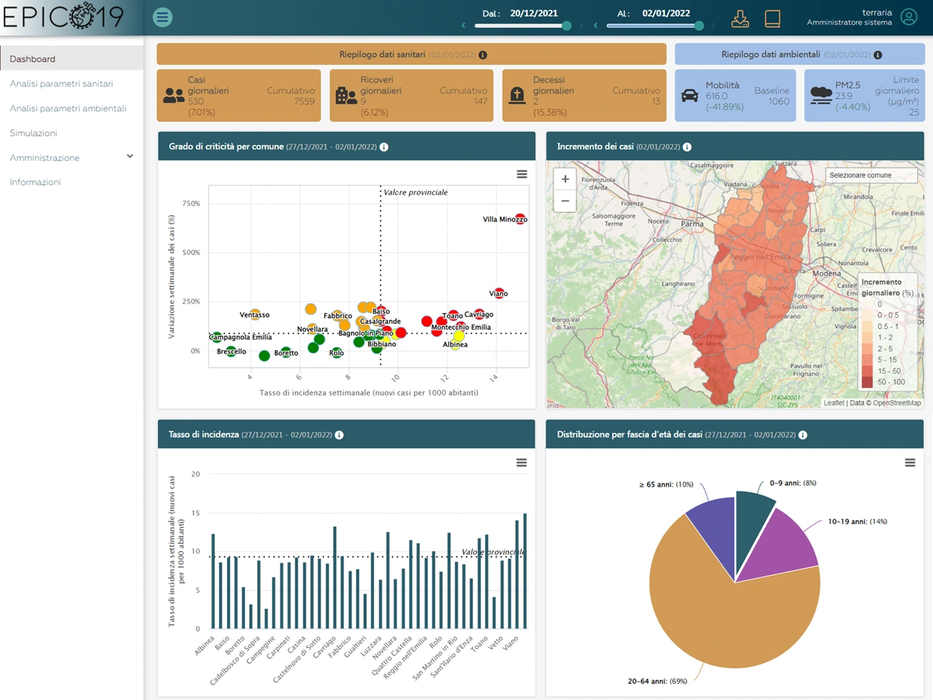
EPICO19 is a web application based on WebGIS (Web Geographic Information System) technologies developed to assess the historical and forecast evolution of a health emergency from both a spatial and temporal perspective, through the analysis of health, environmental and mobility data in urban and regional contexts. The platform is designed to integrate complex geospatial information into an intuitive and interactive visualisation, with the aim of facilitating the understanding and interpretation of epidemiological phenomena related to public health.
The EPICO19 user interface is created using open-source technologies to facilitate its transferability and replicability to other territorial contexts.
Back-end architecture
The technological heart of EPICO19 consists of a back-end system divided into several interconnected modules, each dedicated to the management, processing and integration of specific types of data:
- Spatial and temporal database of health parameters;
- Database of environmental parameters obtained from satellite images, which includes, in particular, concentrations of atmospheric pollutants such as nitrogen dioxide (NO2) and particulate matter (PM10 and PM2.5), indicators of population vulnerability, through a specific engine;
- Database of mobility parameters obtained from high-resolution satellite images (Very High Resolution – VHR), such as the crowding density index and its variation, through a specific engine;
- Machine Learning epidemiological model to predict health parameters and possible additional policy scenarios through a “what-if” approach, for example, modelling what would have happened in past outbreaks, identifying the best interventions to better control a possible future outbreak.
In order to preserve sensitive information such as health data, the EPICO19 DSS has authenticated access dedicated to public health experts. The application has been tested and validated by epidemiologists from the local health authority of Reggio Emilia (AUSL RE), in the territory under its jurisdiction, which includes 42 municipalities, 7 unions of municipalities with approximately 535’000 inhabitants and 6 hospitals.
Product functionality
The EPICO19 web application was developed with the aim of providing an integrated tool for mapping, monitoring and predicting the spread of epidemics, with particular reference to the COVID-19 health emergency, but with a flexible architecture that can be adapted to other epidemic scenarios. The tool is based on a Machine Learning model that works together with health, environmental, and mobility data to simulate how the epidemic situation is changing in the area. In addition, EPICO19 is able to monitor the vulnerability and crowding of the population through satellite observation, respectively modelling exposure to air pollution and counting and geolocating vehicles with an AI engine.
EPICO19 enables a wide range of operational and analytical capabilities including:
- Retrospective analysis, it is possible to reconstruct the spread of past epidemic outbreaks and better understand the dynamics of the health emergency;
- Real-time monitoring, the platform offers tools to monitor the current spread of the epidemic through spread maps, with detailed visualisation at the municipal and census tract level;
- Forecasting future scenarios, thanks to the integrated predictive model, it is possible to simulate the spread of the epidemic and assess the effectiveness of restrictive measures, such as lockdowns or mobility restrictions, to contain the epidemic in the study area;
- Advanced visualisation, the application provides maps and time series relating to health, environmental and mobility parameters, providing useful indicators for users.
- Report generation, the tool is able to dynamically generate reports in PDF format, which include information in the form of graphs and tables on the evolution of the pandemic and, in particular, on the latest week of available data.
Would you like to find out how EPICO19 can support the management of the health emergency?
Contact us for a tailor-made demonstration or for further details about our platform.
We are at your disposal to support you in using satellite data and artificial intelligence, transforming them into timely, secure and operational decisions.
👉 Request a demo
👉 Write to us at: info@terraria.com