Integrated modular system for hazard management and prevention – enriched with satellite data
SIMULATOR-ADS (Integrated Modular System for Risk Management and Prevention – Enhanced by Satellite Data) is a project funded by Lombardy Region that led to the development of an innovative platform and a Decision Support System (DSS) for local Public Administrations (PAs), moving toward a Civil Protection 2.0 approach.
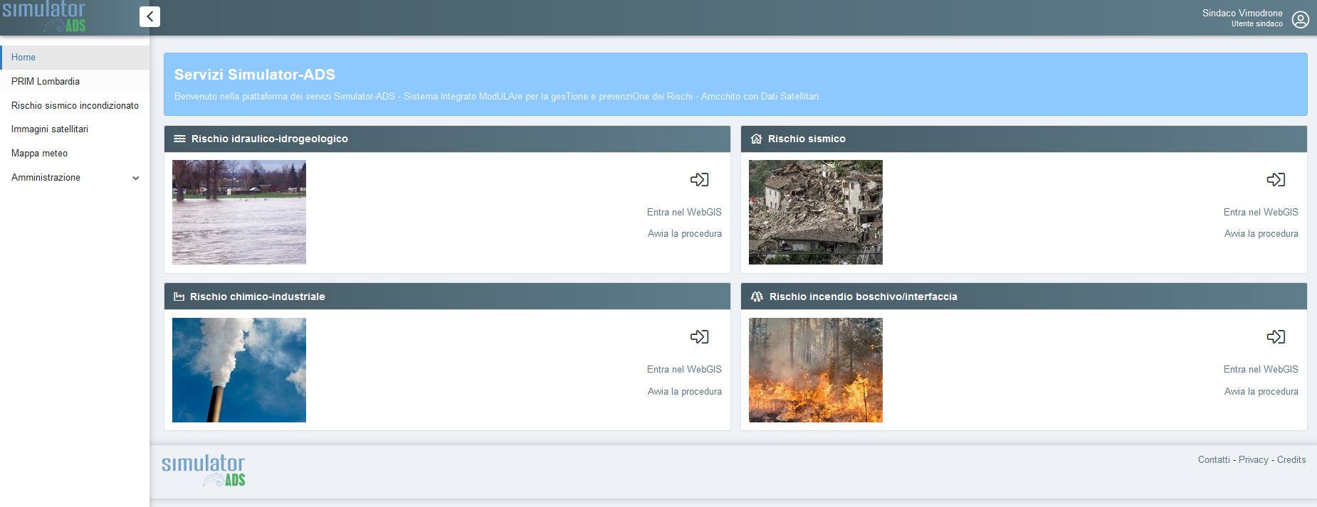
The platform, also named SIMULATOR-ADS, addresses the real need to safeguard the population and territorial assets including services, activities and environmental resources. It also aims to protect and optimise regional infrastructure systems. The system is designed for managing risks arising from natural causes, mainly extreme meteorological and seismic events such as floods, heatwaves, landslides, and earthquakes, as well as from anthropogenic sources, including technological, chemical, or industrial accidents.
SIMULATOR-ADS builds on the experience and results achieved by some partners within the previous SIMULATOR project, which led to the prototype implementation of a Decision Support System for spatial planning and risk management in emergency situations.
| Project Type: LINEA R&S PER AGGREGAZIONI di Regione Lombardia – FESR Budget: 1’189’750 Euro, Managed Activities: 446’250 Euro Duration: 2016 – 2019 Number and Partners involved: 6 project partners all italians, Cefriel project-leader, TerrAria srl, CNR-IDPA MiIano, EUCENTRE, Mixel, Epson Meteo – MOPI Role: Partner |
 |

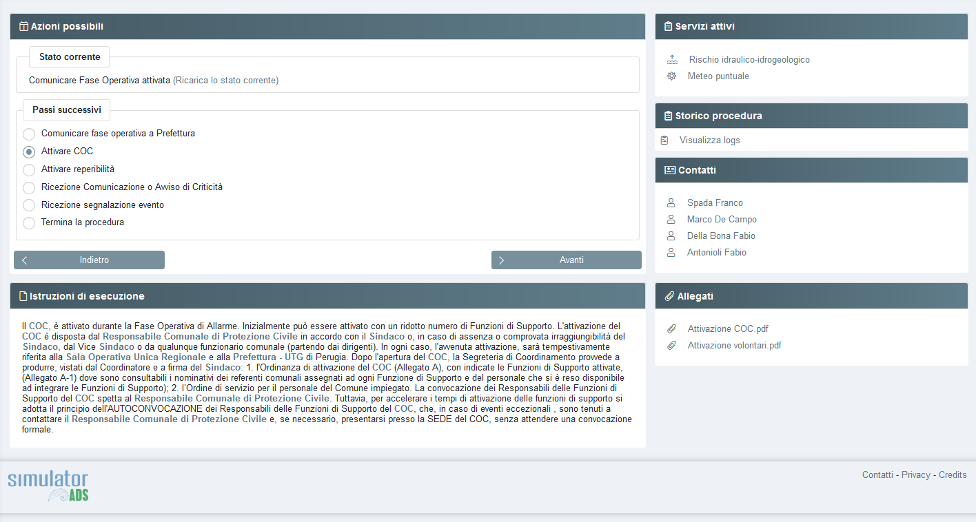
SIMULATOR-ADS enabled an enhancement of the functionalities already available in SIMULATOR (based on feedback from stakeholders involved in the project, where the system had been used at a prototype level), by integrating and making accessible to local authorities a wider range of both risk management procedures and multi-source, heterogeneous information, including static and dynamic data, in real time and/or near real time, related to the territory of interest.
In particular, these data can be derived from:
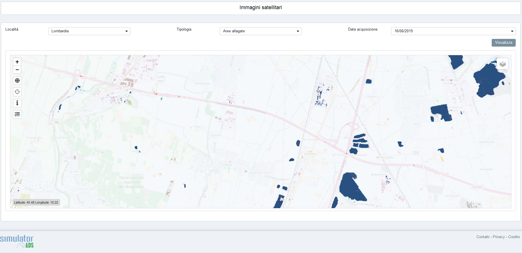
- the processing of remotely sensed images acquired through the Sentinel data hub of the Copernicus programme. For example, a downstream service based on Sentinel-2 satellite data was developed to identify flooded areas. Several spectral indices were calculated and combined using Ordered Weighted Averaging (OWA) techniques. The algorithm was trained to detect potential flooded areas at pixel level by integrating multiple criteria and threshold-based functions;
- real-time reports directly from the field, provided by operators, volunteers, and informed citizens, collected via smart apps, in line with the principles of a more efficient and participatory Civil Protection system;
- measurements collected through local institutional sensors for monitoring high-risk sites;
- meteorological forecasts and data;
- existing official databases (such as PGTWEB and PEWEB) and outputs from scientific research, particularly risk scenario simulation models.
The platform is also conceived as part of an open digital ecosystem, designed for integration via APIs (Application Programming Interfaces) with regional services, promoting interoperability among systems and collaboration between public and private stakeholders. This approach enables coordinated and scalable management of information and decision-making processes in the field of Civil Protection.
THE ROLE OF TERRARIA
TerrAria was responsible for:
- improving and enhancing the cartographic engine initially developed within the SIMULATOR project, optimising its capabilities for risk management support;
- integrating all components into the IT platform, with particular focus on the new Decision Support System developed by the National Research Council of Italy (CNR). This service was developed in an open-source environment to ensure that system deployment is not dependent on proprietary licensing;
- enabling the acquisition of temporally dynamic information by integrating the satellite image analysis service developed by the Institute for electromagnetic environmental monitoring (IREA) of the CNR, and incorporating the outputs of this processor into the cartographic engine. This allows users to perform post-event assessments of actual damage areas derived from satellite data, leveraging data from the European Earth Observation Programme “Copernicus” and IREA’s expertise in estimating biogeophysical parameters and mapping burned areas, key tools for an advanced, prevention-oriented Civil Protection system.